
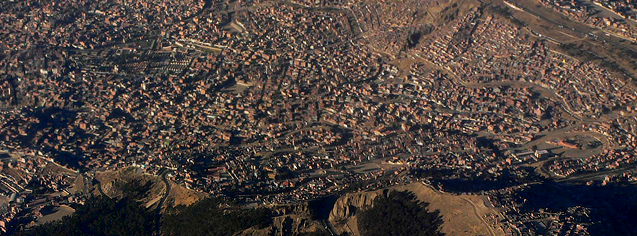
The GFDRR Innovation Lab has played a vital role in the Plurinational State of Bolivia’s national disaster risk management (DRM) strategy by guiding the development and supporting the implementation of GeoSINAGER, a robust, geospatial federated platform where multiple agencies and institutions can integrate their own platforms. In La Paz, the data-sharing platform is at its most critical phase of incorporating the Ministries of Planning for Development, Health and Sports, Education, Rural and Land Development, and Environment and Water. This first phase also targets both federal and local government.
GeoSINAGER was developed by Bolivia’s Vice-Ministry of Civil Defense (VIDECI), to facilitate knowledge exchange among all partners of the National System for Risk Reduction and Disaster and Emergency Awareness (SISRADE), under the legal and institutional framework of SINAGER.
GFDRR Labs’ History in Bolivia
GFDRR Labs’ contribution to the establishment of Bolivia’s national DRM practice (Figure 1) dates back to 2011 with Mr. Ankur Sha’s mission to meet with VIDECI government official Captain Carlos Mariaca (SINAGER’s Chief) and the World Bank’s country office DRM specialist, Marco Antonio Rodriguez, to share GFDRR Labs’ OpenDRI successful practices, community-building activities in other countries and their suite of open source software tools. His influence resulted in VIDECI’s decision to develop GeoSINAGER using GeoNode as its new software platform.

Figure 1: GFDRR Labs' Contribution Timeline
Enter Ariel Nuñez in 2012 to support the design and construction of GeoSINAGER through technical videoconferences, remote training sessions and testing exercises with Captain Mariaca and SINAGER’s Richard Gonzalez and Leonardo Jauregui. This involvement supported the technical development of the open source platform. Consequently, in November 2012, VIDECI hosted Bolivia’s first national Disaster Risk Information Collection and Integration Capacity Building Workshop in La Paz, an advanced GeoNode training workshop and technical dialogue for the usage and construction of GeoSINAGER. Mr. Nuñez led the hands-on workshop tailored for 40 technical experts from government agencies and scientific institutions.
The added capacity that resulted from this training helped set the stage for VIDECI’s continued engagement with a constellation of other government agencies, institutions and other technical-scientific institutions that generate DRM-relevant knowledge, such as the National Geology Services and Technical Mines (SERGEOTECMIN), the Military Geographic Institute (IGM), the National Service of Meteorology and Hydrology (SENAMHI), the National Statistical Institute (INE) and others. This newly created institutional network takes GeoSINAGER to its next level of collaboration.
Furthermore, Nunez’s workshop garnered the attention of Bolivia’s Vice-minister, Dr. Oscar Cabrera, who publically displayed great satisfaction on behalf of GeoSINAGER to strengthen the country with a federated platform capable of connecting DRM information, pertinent knowledge and ideas across multiple sectors and institutions. Furthermore, Nuñez’s efforts have also supplemented other efforts from the World Bank’s Emergency Recovery and Risk Management Lending Project (PREGD) with Bolivia’s Ministry of Planning for Development (Ministerio de Planificación del Desarrollo), under Armando Guzman’s team leadership.
Results
GFDRR Labs’ technical leadership has resulted in:
- Increased technical capacity of 40 key administrators who can proceed with GeoNode implementations with a deeper understanding of the development and scalability potential of their respective systems, based on real life examples in the Caribbean and Indonesia.
- Achieving systems interactivity between GeoSINAGER and the broader Plurinational State of Bolivia’s national geospatial data system GeoBolivia, developed on geOrchestra, a French open source software. Nuñez developed fixes to smooth out integration points, interoperability and information planning for the two platforms, something that nobody in Bolivia had been able to achieve.
- Establishing a more solid connection between GeoBolivia and GeoSINAGER. This has significantly raised the profile of Bolivia’s national DRM initiative; hence, facilitating the creation of a new local technical chapter within the Open Source Geospatial Foundation (OSGeo) community, and within it, a new community of practice dedicated to share knowledge about various open source Global Information Systems (GIS) platforms: GeoNode, geOrchestra, QuantumGIS, InaSafe and others.
- Increasing participants’ commitment to the national DRM agenda and the identification of a critical path to implement the objectives and activities that will lead Bolivia into completing its National Disaster Observatory and risk reduction systems infrastructure. GFDRR Labs is part of that commitment to continue enhanced supporting technical and leadership capacity for Bolivia’s DRM technical community federation.
VIDECI’s and SINAGER’s Capitan Mariaca, Leonardo Jauregui, Vladimir Rivera and Richard Gonzalez, interviewed this January 2013, all resonated that, “the value of having the GFDRR Labs’ mentoring and technical assistance has been enormous because it has allowed us the ability to work within a network of data and knowledge contributors that are now trained for deeper implementation. Ariel’s training has also permitted us to move beyond the limited normalcy we were facing, which has achieved interoperability between GeoSINAGER and GeoBolivia, something that was critical for the integration of our work. Now the data we had available can be published in a centralized fashion. The gains have truly been enormous.”

Photo: The new OSGEO Community of Practice
Moving Forward
As soon as GeoSINAGER ascertains that its data-sharing component is being utilized and populated successfully, its focus must then shift to using its data for decision-making and disaster contingency planning. GFDRR Labs will be instrumental during this shift as it helps Bolivia leverage the lessons learned from East Asia and the Pacific on contingency planning tools (InaSAFE). It will also be important for VIDECI to leverage other ongoing nationwide projects to impact decision-making and contingency planning.

Figure 2: GeoSinager’s Next Steps for Decision-Making and Contingency Planning
VIDECI’s growth plan for 2013 is to deploy 20 more GeoNodes throughout nine of their largest ministries, some still without GeoNodes. Deployments are also being planned through its decentralized governmental agencies so everyone can visualize risk assessment. Beyond implementing at the federal level, implementation at the municipal level is also being planned. Bolivia itself has 337 municipalities; their vision is to extend to at least 18 municipalities in the next two to three years. They also realize the great need to promote this work at all levels in order to foster national enthusiasm and engagement.
Content and photos: Ariel Nunez and Maria Madrid.
For additional information, contact mmadrid@worldbank.org.