
By Masatsugu Takamatsu, Ahsan Tehsin, and Faridun Sanginov
Tajikistan’s dramatic mountains are a source of beauty, water, and risk. Steep terrain, combined with the effects of climate change, makes the country especially vulnerable to hazards like mudflows, landslides and glacial lake outburst floods. These disasters often cut off critical roads, isolate communities, and disrupt trade routes that connect Tajikistan with its neighbors. Most recently, a road section in the Lakhsh district, a part of the international Vahdat – Rasht – Lakhsh highway to the Kyrgyz Republic border was inundated due to a series of glacier lake outburst floods, making travel for local communities quite challenging.
To address these risks, the World Bank is working with Tajikistan’s Ministry of Transport (MoT) to pilot innovative ways to identify and prioritize dangerous road sections that require mitigation measures. To do this a geohazard risk screening was first carried out. This was undertaken to support implementation of the World Bank’s Tajikistan Preparedness and Resilient to Disasters Project (PREPARED) and was made possible through the technical assistance provided by the Global Facility for Disaster Reduction and Recovery’s (GFDRR) Japan-World Bank Program for Mainstreaming Disaster Risk Management in Developing Countries.
Before conducting field inspections, the project procured high-resolution satellite-based topographic data (2.5m digital surface models) and high-resolution satellite imagery (50 cm orthophotos) to screen a 200 km stretch of the target highway between Labijar and Karamyk, an important link to the Kyrgyz Republic. The screening utilized the high-resolution data to identify more than 150 hazardous sites – those with signs of slope deformation, rockfall, debris flow, or riverbank erosion. This approach proved cost-effective, allowing fairly accurate longlisting of priority sites even before field inspections began.
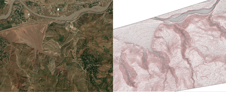
Figure 1. Sample satellite-based 50 cm resolution orthophoto (© CNES (2024), Distribution Airbus DS) and 2.5 m resolution digital surface model (NTT Data Corporation, JAXA) utilized for screening geohazard risk area along the target road.
Following the field inspection and consultation with the MoT, priority sites were identified for more detailed drone surveys. The drone-based data provided additional insights into tree distribution, recent slope failures, and cross sections of dry streams cutting through the road — this is all critical information for conceptualizing and designing mitigation measures for culverts, bridges, and upstream channels, to be potentially implemented under the PREPARED project.
Equally important, the project helped build local expertise. More than 20 staff from Tajikistan’s MoT received hands-on training for analyzing topographic and geospatial data using GIS for risk evaluation and the planning and design of mitigation measures. At the final workshop, participants highlighted the GIS training as particularly useful as well as the development of mitigation planning that included nature-based solutions. The GIS and road geohazard mitigation planning skills enhancement now enables MOT to better prepare for and respond to future road disruptions and provide targeted support for communities, like those in Lakhsh district, whose livelihoods and businesses are heavily dependent on the highway.
By combining cutting-edge data and analysis with capacity building, Tajikistan is taking concrete steps toward safer and more resilient road infrastructure.
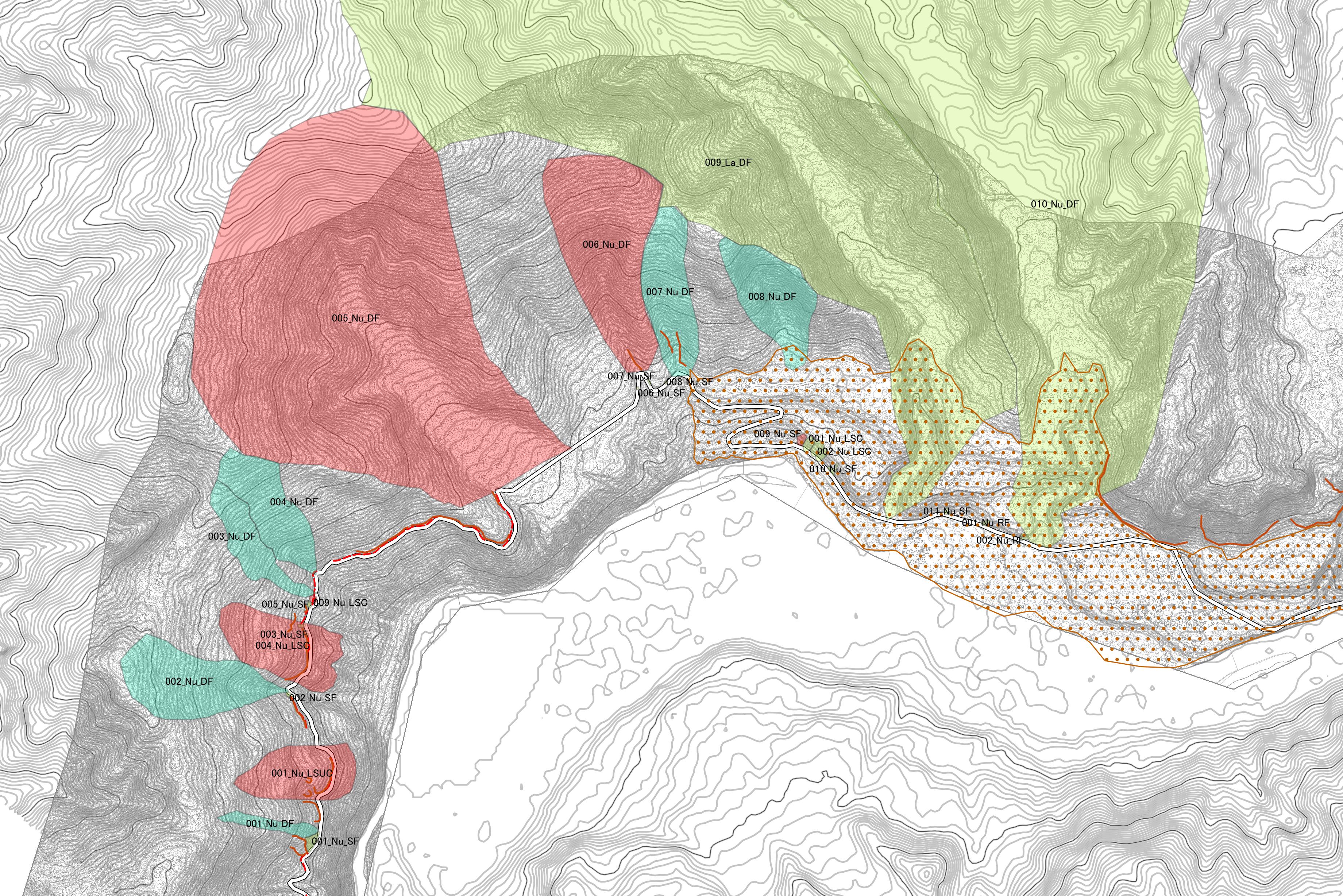
Figure 2. Delineated hazardous areas utilizing high-resolution topographic and orthophotos. © World Bank