


Dominica: Spatial Data Management and Identification of the Most Vulnerable Schools and Shelters
Context and Objectives
The project aimed at reducing Dominica’s vulnerability to natural hazards and climate change impacts by identifying and undertaking specific hazard and disaster risk assessments.
Main Activities and results
- Establishment of a Spatial Data Management and Sharing Platform for Hazard and Disaster Risk Assessments
- Conducting a Vulnerability Assessment and Multi-Criteria Evaluation of schools and emergency shelters to inform the choice of investments under the World Bank-financed Disaster Vulnerability Reduction Project.
- Facilitate a Multi-Criteria Evaluation (MCE) for the prioritization of investments (schools and shelters) to be included in the Disaster Vulnerability Project/Pilot Program for Climate Resilience.
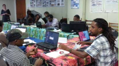
The Spatial Data Management and Identification of Most Vulnerable Schools and Shelters project, launched in December 2012 and implemented by the WB, closed in June 2017.
This Vulnerability Assessment and a Multi-Criteria Evaluation of schools and emergency shelters, together with the newly set-up risk data management platform (the Dominode):
- Helped to better inform the choice of investments under the proposed Disaster Vulnerability Reduction Project, financed by the World Bank and effective from September 8, 2014.
- Supported the government in identifying and retrofitting vulnerable shelters, and in designing and constructing new resilient structures.
- Increased the Government of Dominica’s capacity to manage and share geospatial data, promoting a culture data sharing, for informed decision making at multiple levels.
To ensure sustainability and wide use of these outputs, the project team integrated the project results under a national monitoring and evaluation framework. This framework aims to provide a mechanism for national monitoring of climate resilience outcomes and progress across all public, bilateral and multilateral investments. The project team reinforced the national monitoring and evaluation framework, and consolidated geospatial related work. This activity supported a systematic approach to results monitoring, impact evaluation, knowledge management and learning at the program level.
Partnerships and Coordination
The project worked closely with a number of government departments including Office of Disaster Management, Local Government Department, Ministry of Public Works and Ports, Physical Planning Division, Information Communications Technology Unit, DVRP/PPCR Project Coordination Unit and Ministry of Health
Officials from the EU were informed about advances in the project and invited to participate in the closing event.
Country
Region
- Caribbean
Priority area
- Risk identification and assessment
Window of Action
- Window 2
Amount approved
- $719,829
Co-financing
- $0
Duration
- 12/2012 - 06/2017