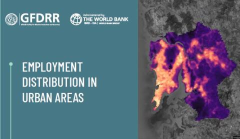
Description: GFDRR has developed a methodology to proxy for the spatial distribution of jobs in urban areas using
only globally available and public data (through OpenStreetMap and Google Earth Engine). The methodology has
been successfully tested and validated against employment data in 14 cities of the developing world.
Sector: Transport, urban, disaster risk management (DRM), poverty.
Download the full document here.